Washington’s bikepacking scene has reached new heights with the launch of the Loowit Tier. This ambitious trail is the first completed part of what could become the world’s longest mountain bike route. The trail runs 197 miles from Packwood to White Salmon along the Washington-Oregon border. Riders will climb more than 33,000 feet through some of the Pacific Northwest’s most beautiful landscapes.
The Loowit Tier marks one of the most important steps for the Orogenesis project. This massive undertaking started in 2017 and ended up with plans to build a continuous 5,000-mile bikepacking route from British Columbia to Baja California. The trail runs through Gifford Pinchot National Forest and Mount St. Helens National Volcanic Monument. Riders who want to tackle this challenging segment should plan for a 6-to-8-day experience. The difficulty rating stands at 8 out of 10, and the trail combines everything in route planning, navigation, and camping. It offers an unmatched bikepacking adventure that showcases Washington’s varied terrain while putting both gear and endurance to the test.
Orogenesis Collective unveils Loowit Tier in Washington
The Orogenesis Collective just released the Loowit Tier, a well-crafted bikepacking segment that takes riders through Washington’s varied terrain. This release comes after years of planning and trail restoration work across the Pacific Northwest.
Trail stretches 197 miles from Packwood to White Salmon
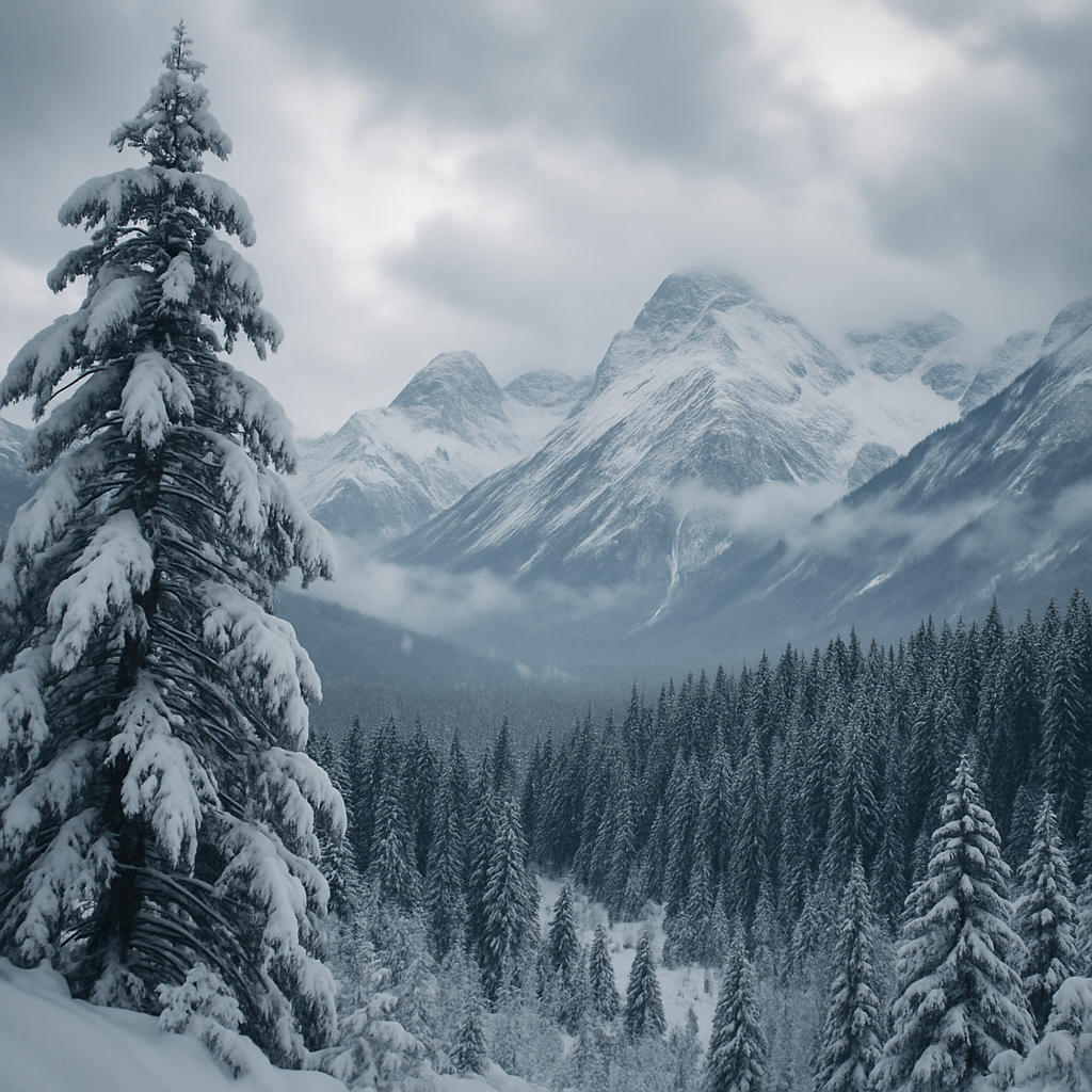
The new Loowit Tier creates a tough 197-mile route that links the small mountain town of Packwood to White Salmon along the Columbia River Gorge. Riders who take on this challenging segment will explore a diverse landscape that has moss-laden forests, aquamarine swimming holes, and the surreal expanses of the Mount St. Helens blast zone.
This route stands out with its unique mix—49% singletrack trails, 40% dirt roads, and just 11% paved surfaces. Bikepackers face a physically demanding trip rated 8 out of 10 for difficulty, while technical challenges sit at 6 out of 10.
“The riding in the Gifford is notoriously steep, remote, and rugged, but the views and descents make it worth your while,” notes the Orogenesis Collective. The route brings some real logistical challenges, especially when it comes to resupply options. Riders should know that they’ll find only two resupply points along the entire tier, with the first one at Northwoods, about 100 miles from Packwood.
The trail crosses ancestral lands of several indigenous peoples, including the Cowlitz, Siletz, Yakama, Klickitat, and Wishram. Riders will reach a peak elevation of 5,374 feet during their trip. Most bikepackers take 6-8 days to complete the route, though experience and gear choices affect timing.
Launch marks first official segment of 5,000-mile route
The April 23, 2025 release of the Loowit Tier marks a vital milestone for the Orogenesis project. This launch sets up the first officially published segment of what will grow into a 5,000-mile bikepacking route from British Columbia, Canada, to Baja California’s southern tip.
“In less than two weeks we’ll release the first tier of the Orogenesis route publicly: Packwood Washington to the Columbia River Gorge,” project leaders announced on April 9, 2025. They picked perfect timing, as the best riding conditions for the Loowit Tier run from mid-July through October.
The Orogenesis Collective has laid out a bold schedule for more segments. “Amadeus is finally ready to begin publishing the missing route segments for the Orogenesis Trail. The Loowit Tier is the first segment he’s published, but he plans to release five more segments through spring and summer 2025,” a project update states. Riders can look forward to 874 miles of trail sections “ready for your tires and curiosity” throughout 2024.
The team worked hard on trail restoration to prepare for this launch. They spent three years fixing up the Klickitat Sisters #7 Trail near Packwood. June will bring more restoration work in Indian Heaven—”the last few miles along the Loowit Tier that need to be opened up before the first riders pass through in July”.
This first segment’s release brings the dream of creating the world’s longest mountain bike trail closer to reality. Serious bikepackers now have an amazing chance to experience Washington’s stunning landscapes on this carefully planned route.
Trail builders restore forgotten paths through Gifford Pinchot
Years of careful restoration work lie behind every mile of the new bikepacking routes. Dedicated volunteers have worked to bring back forgotten paths in Washington’s Gifford Pinchot National Forest. These paths are the foundations of the ambitious Orogenesis project.
Volunteers revive Klickitat Sisters Trail
The revival of the Klickitat Sisters Trail shows evidence of volunteer commitment in Washington’s backcountry. Volunteers invested more than 1,156 hours to restore this historic 17-mile route in three years. This trail stands out as the longest non-wilderness path without road crossings in the Gifford Pinchot National Forest. The trail’s cultural heritage runs deep as an ancient trading route between the Klickitat and Cowlitz peoples, dating back roughly 3,000 years.
“After that particularly hard day in July we asked the crew ‘How can we make these events easier when the trail is so hard’, and bless their hearts they just smiled and said ‘We keep coming back because it’s hard,'” recalled one organizer. The volunteers deepened their commitment despite tough conditions. They faced deep snow drifts in mid-July during initial work and record mosquito numbers in later years.
Workers logged an impressive 590 hours worth about $18,800 toward trail restoration in just one weekend. Certified chainsaw operators used their specialized skills to clear fallen trees along the remote corridor. Evergreen Mountain Bike Alliance’s Cowlitz-Naches chapter provided vital support through their volunteer service agreement and sawyer program.
The work meant more than just trail maintenance to many participants. One volunteer reflected after experiencing the completed trail: “It’s almost psychedelic to see and experience the interconnectedness of prominent landmarks and precious zones. The connection to the past means a lot to me and for those sensitive to our delicate place in time, there’s a deep well of energy that’s only available in such rare spaces”.
Use of lidar and historical maps to locate lost trails
Advanced technology, especially Light Detection and Ranging (LiDAR), helps bring forgotten paths back to life. This remote sensing method uses laser light pulses—over 150,000 per second—to create detailed topographical data that penetrates dense forest canopy. LiDAR creates “bare earth” images by digitally removing vegetation, which reveals subtle ground features hidden from aerial photos or direct observation.
Trail teams use LiDAR-generated hillshade models to spot potential historical trail traces, swales, and ruts beneath the forest floor. This technology helps surveyors “see through” decades of forest growth covering abandoned paths when regular evidence is hard to find.
The process starts with LiDAR analysis to identify promising areas. Volunteers then verify these findings against historical maps and records on the ground. This approach works well throughout the Gifford Pinchot National Forest, where lack of maintenance had made many trails hard to access.
Washington Trails Association received a $20,000 grant from the National Forest Foundation in 2017 to restore 24 “lost” trails throughout the forest. Washington’s growing bikepacking community benefits from these restoration projects. The work creates vital connectors for route planning while preserving paths with rich cultural heritage.
Orogenesis aims to connect British Columbia to Baja
The Orogenesis vision reaches way beyond Washington’s borders. This ambitious project covers nearly the entire western edge of North America. The goal is to create an uninterrupted 5,000-mile bikepacking route along the western lip of the North American Tectonic Plate—from British Columbia’s rugged mountains to the sun-baked tip of Baja California.
Project inspired by Oregon Timber Trail and Baja Divide
The Orogenesis story began in 2017 when two major bikepacking routes emerged almost at the same time: the Oregon Timber Trail and the Baja Divide. Gabriel Amadeus Tiller, Executive Director of the Orogenesis Collective and a founder of the Oregon Timber Trail, saw a great chance when looking at both routes on the same map.
“When we published the Oregon Timber Trail, another route called the Baja Divide was published the same year,” explains Tiller. “And if you look at the two on the map, you’re like, ‘Well, we’ve got to connect the two through California.’ They’re both these two linear routes. They’re pointing at each other. So it just seemed like the obvious thing to do”.
This original idea grew into exploring how to extend the connection further north. The team ended up creating a complete route from Canada to Mexico. The Oregon Timber Trail provides about 700 miles of 91% unpaved route. This forms a vital middle segment for the larger Orogenesis vision.
Route already 90% off-pavement with minimal new construction needed
What’s amazing about this continental-scale project is how much already exists. The preliminary assessments show only about 206 miles of “gaps” where no suitable riding options exist. This makes up less than 5% of the entire 5,000-mile route.
“We found about 206 miles of ‘gaps’ where we’ve deemed there to be no current suitable option for riders. That may seem like a lot, but it’s less than 5% of the entire route—all of a sudden we realized just how close to blooming this entire juicy ribbon of trail was,” notes the Orogenesis team.
The complete Orogenesis route has seven chapters:
- Colemonti Crossing (Washington)
- Oregon Timber Trail
- Winema Way (Northern California)
- Sierra Camino (East Sierra)
- Sierra Teleli (West Sierra)
- Anillo de Los Ángeles (Southern California)
- Baja Divide
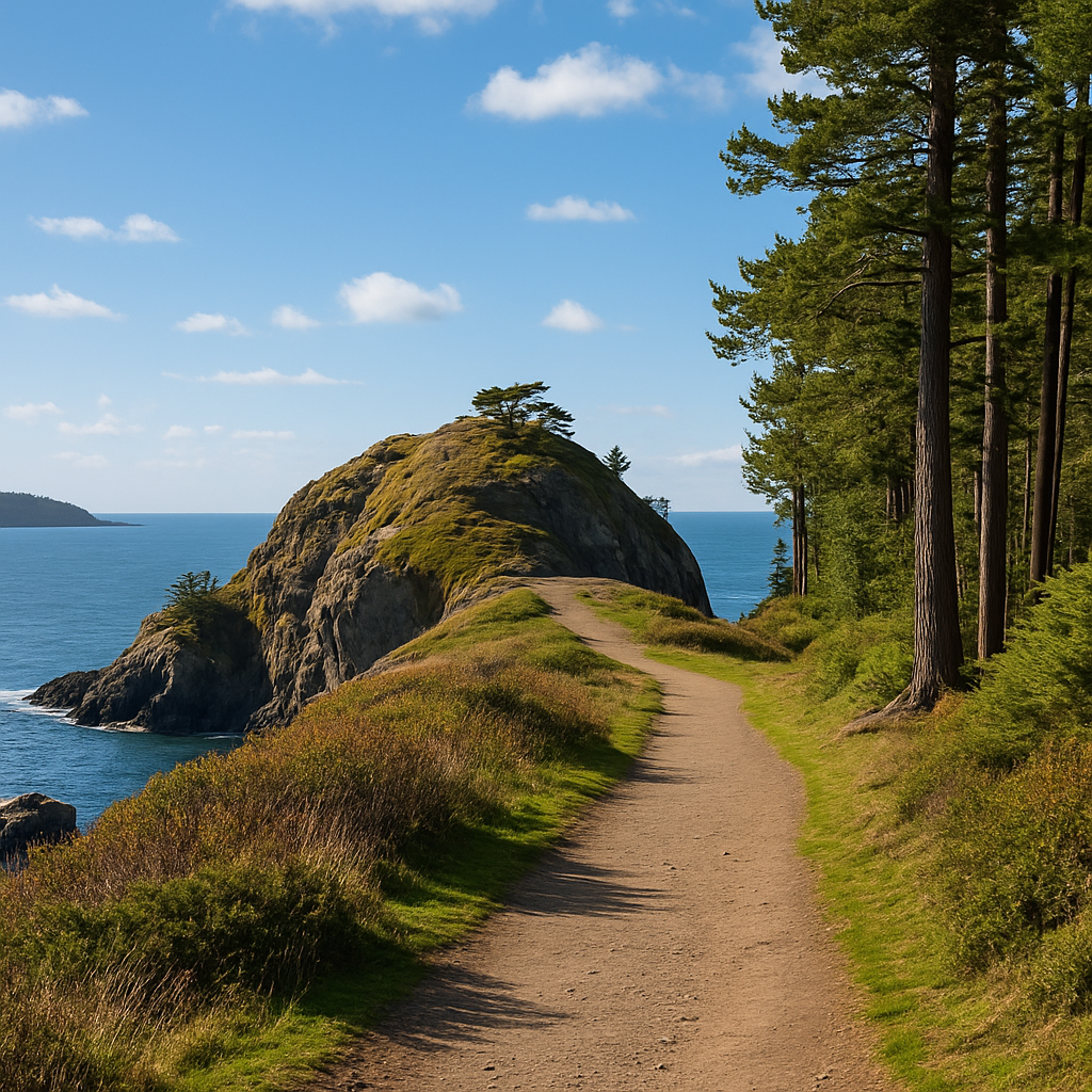
Two chapters—the Oregon Timber Trail and Baja Divide—are complete. The Baja Divide spans approximately 1,700 miles from San Diego to La Paz. It features dirt tracks and rugged terrain connecting the Pacific Ocean and the Sea of Cortez.
Future thru-riders attempting the entire 5,000-mile journey will likely start at the Canadian border in mid-July. This timing helps them avoid late-melting snowpack in the north while reaching the southern Sierra by November before snow arrives there and Baja’s heat subsides.
About 75% of the trail is bikeable right now, even with the existing gaps. The team plans to raise this percentage through mutually beneficial alliances and improvements in the coming years.
Advocates push for federal support to complete trail
Federal legislation is a vital factor that drives the continental-scale Orogenesis route forward. Trail supporters now focus on policy changes to speed up its completion. The project needs federal backing due to its size and requires coordinated action from multiple jurisdictions and land management agencies.
Biking on Long-Distance Trails Act could ease permitting
The bipartisan Biking on Long-Distance Trails (BOLT) Act leads these efforts. Senators Ben Ray Lujan (D-NM) and Kevin Cramer (R-ND) first introduced this legislation in 2021. The act wants to identify and develop off-road bicycle trails throughout the United States.
“In New Mexico and across America, there are millions of acres of federal lands that have gone untapped for responsible outdoor recreation use,” stated Senator Lujan. “This bipartisan legislation will make bike trails more available and safer across America and will provide a much-needed boost to the growing outdoor recreation economy”.
The BOLT Act, if passed, would require federal land managers to identify at least 10 existing long-distance bike trails. They would also need to find 10 more areas where new trails could be built. The law defines “long-distance trails” as continuous routes that stretch at least 80 miles on federally-managed lands. These trails would mainly use dirt or natural surfaces instead of pavement.
The bill gained strong support when President Biden signed it into the EXPLORE Act. This move finally pushed the BOLT Act “over the line and into law”. The Department of Interior must now establish at least 10 long-distance bike routes that will receive federal funding.
Local coalitions propose new trail near Packwood
Local organizations like the Packwood Trail Project work alongside these federal efforts. This registered 501c3 group partners with community members and land managers to build and maintain trails around Packwood, Washington.
The project moves through several stages. The team builds community consensus, develops trail proposals, gets Forest Service evaluation, and secures funding. US Forest Service must approve all proposals before construction starts. The team also needs enough funding to ensure they can complete and maintain the trails.
The Packwood project explains how much trail development costs. Trail builders usually charge about $25,000 for each mile of construction. Bridge costs can reach $200,000 per linear meter. On top of that, trailhead facilities with paved parking and restrooms might cost $150,000.
Communities see many benefits from this investment. They get well-defined recreation spaces and connections to existing trail networks. The project creates loop hiking opportunities and potential event venues. It also builds stronger relationships with land management agencies.
Riders test the limits on Washington’s Colemonti Crossing
Elite bikepackers now flock to Washington’s Colemonti Crossing in search of the ultimate endurance challenge. This first segment of the Orogenesis route puts both physical limits and equipment durability to the test.
33,000 feet of elevation gain over rugged terrain
The Colemonti Crossing’s 33,000 feet of cumulative elevation gain across 197 miles pushes riders to their limits. The trails through Gifford Pinchot National Forest score 8/10 for physical difficulty and 6/10 for technical challenge. Riders must tackle endless climbs along the way.
The route’s makeup tells the story of its intensity: 49% singletrack trails, 40% dirt roads, and just 11% paved surfaces. The challenging terrain rewards adventurers with breathtaking views of Mount St. Helens. The path through the mountain’s blast zone creates an unmatched bikepacking experience in North America.
Riders must plan their water stops with care. Some remote sections have no cell service. Most bikepackers take 6-8 days to finish the crossing, though experience level and weather play a big role in completion times.
First full-state rider shares experience and challenges
Gabriel Amadeus Tiller leads the Orogenesis Collective as Executive Director and ranks among the first to complete Washington’s entire segment. He documented key navigation points and tackled unexpected challenges during his trip.
“The riding in the Gifford is notoriously steep, remote, and rugged, but the views and descents make it worth your while,” Tiller said after his expedition.
His account gave an explanation of several key challenges:
- The route has only two resupply points, with the first one 100 miles from Packwood
- Many sections lack adequate water sources, so planning ahead becomes vital
- Weather changes faster, so riders must pack versatile gear
Tiller suggests riders tackle the route between mid-July and October. The trails reach their best condition during this window, helping riders avoid late-melting snow and early autumn rains that reshape the scene completely.
Ambitious Backbone of Western Adventure Takes Shape
The Loowit Tier is just the start of a project that will reshape the scene for bikepacking enthusiasts across North America. Rugged Washington terrain leads through Oregon’s trails and ends up at Baja’s sun-drenched paths. The Orogenesis vision offers an exceptional chance for human-powered exploration.
This first 197-mile segment shows remarkable progress through volunteer commitment and technical breakthroughs. Teams have uncovered pathways lost to time by using LiDAR technology, historical research, and thousands of volunteer hours. These efforts protect natural landscapes and cultural heritage while creating environmentally responsible recreation options.
The BOLT Act’s inclusion in recent legislation makes federal support more likely. This backing could speed up development of remaining segments. The most impressive part remains that 95% of the planned route already exists in some form. Connecting British Columbia to Baja California now seems within reach.
People who support the trail highlight economic benefits for communities along the route. Towns like Packwood could gain by a lot from increased tourism when development balances access with conservation priorities.
Weather and terrain challenges limit the number of riders who can complete full trips. Notwithstanding that, each segment offers shorter adventure chances for riders with different abilities. Riders seeking the ultimate challenge can tackle Washington’s 33,000 feet of elevation gain, while others might choose gentler sections.
The Orogenesis project showcases a remarkable achievement in shared conservation and recreation development. The full 5,000-mile vision needs years of work, but the Loowit Tier’s completion proves the concept works. Major hurdles remain – funding gaps, permitting challenges, and physical trail construction among them. Yet the dedicated community behind this continental-scale project stands ready to meet these challenges.