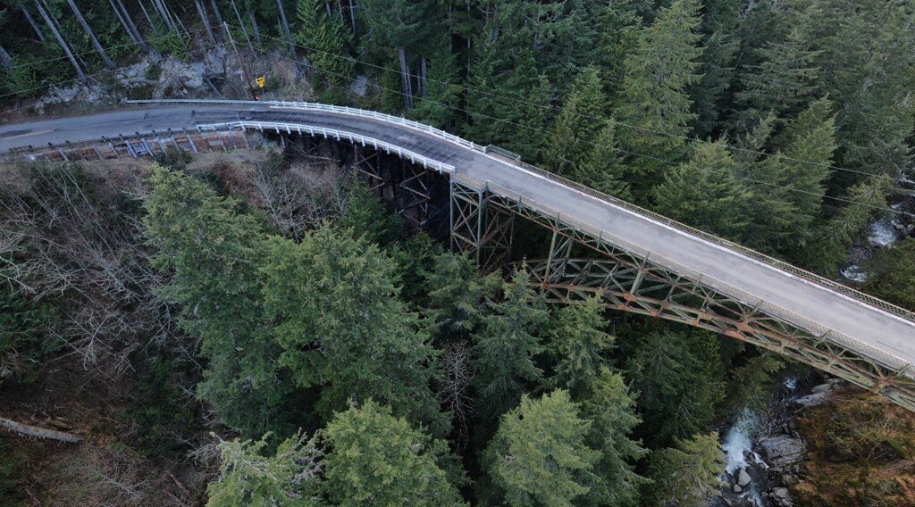
A critical access route into the northwestern corner of Mount Rainier National Park has been severed indefinitely, following the permanent closure of the 103-year-old State Route (SR) 165 Carbon River/Fairfax Bridge by the Washington State Department of Transportation (WSDOT) in April 2025. While located just outside the park boundary near milepost 11.5, three miles south of Carbonado, the bridge served as the sole public conduit from SR 165 into the park’s Carbon River and Mowich Lake areas. Its sudden closure represents an abrupt and complete severance of a primary access corridor for park visitors and recreationists.
The decision eliminates all public vehicle and pedestrian access across the Carbon River via SR 165, effectively isolating the park’s Carbon River entrance, the Carbon River Ranger Station, and the seasonal Mowich Lake entrance. Official alerts from both WSDOT and the National Park Service (NPS) emphasize the totality of the closure, stating there is “NO access” and confirming the lack of any available public detour or alternate route. This development, driven by urgent safety concerns regarding the bridge’s deteriorating structure, occurred just ahead of the park’s busy summer season, raising concerns about lost recreational opportunities and potential economic impacts on nearby communities.
“No Longer Safe”: WSDOT Cites Critical Structural Failures
The path to permanent closure began on April 14, 2025, when WSDOT announced an immediate, indefinite closure of the Fairfax Bridge as a safety precaution. This initial action followed recent inspections that revealed “new deterioration of steel supports” on the century-old span.
Just over a week later, on April 22, 2025, WSDOT made the closure permanent. Follow-up inspections confirmed the severity of the structural issues. WSDOT Olympic Region Administrator Steve Roark stated, “It’s very apparent from the visual changes in the columns that the bridge is no longer safe to use”. Photographic evidence released by the agency showed a critical support column was “bent in two directions and starting to buckle,” indicating a high risk of failure. The specific and severe nature of this failure left WSDOT concluding it had no alternative. “Closing the bridge was our last option,” Roark added, acknowledging the significant consequences of the decision.
The bridge itself, a single-lane steel truss structure spanning 494 feet, opened to travelers in 1921. While WSDOT established a 9-mile emergency access detour route in 2024 for first responders and local property owners situated south of the bridge, this route remains explicitly closed to the general public.
Mount Rainier’s “Quieter Side” Now Largely Out of Reach
The Fairfax Bridge closure effectively seals off the northwestern quadrant of Mount Rainier National Park to the public approaching via SR 165. This includes the year-round Carbon River entrance, which saw nearly 16,000 vehicles in 2024, and the seasonal Mowich Lake entrance, typically accessed via Mowich Lake Road from mid-summer through the first major snowstorm.
Consequently, numerous popular destinations and recreational activities within this unique section of the park are now inaccessible from their traditional starting points or require vastly different approaches. Key areas cut off include:
- The Carbon River Ranger Station.
- Primary access to the Carbon River Trail, leading towards the Carbon Glacier. This trail follows the path of the old Carbon River Road, which itself was closed to vehicles after severe flood damage in 2006.
- The Ipsut Creek Campground, now a backcountry site located at the end of the former Carbon River Road.
- Mowich Lake, the park’s largest and deepest lake, accessible seasonally by road.
- Trailheads at Mowich Lake serving highly popular day hikes such as the Tolmie Peak Lookout trail (famous for its fire lookout and reflection lake views) and the Spray Park Trail, known for stunning wildflower meadows and Spray Falls.
- Access to the unique ecosystem of the Carbon River valley, noted for its rare inland temperate rainforest climate.
Reaching these destinations now necessitates significantly longer, multi-day backpacking expeditions originating from other park entrances, a stark contrast to the previous vehicle, bicycle, or day-hike access afforded by the SR 165 route. The closure also impacts gateway communities like Wilkeson, where businesses depend significantly on the influx of summer visitors drawn to this part of the park.
The following table summarizes the impact on key features previously accessed via SR 165:
Impact of Fairfax Bridge Closure on Mount Rainier Access
| Feature/Area | Status | Previous Access Method (via SR 165) |
|---|---|---|
| Carbon River Entrance | Inaccessible via SR 165 | Vehicle to entrance, then hike/bike on road/trail |
| Mowich Lake Entrance | Inaccessible via SR 165 | Seasonal vehicle access on Mowich Lake Rd |
| Carbon River Ranger Station | Inaccessible via SR 165 | Vehicle |
| Carbon River Trail/Glacier | Inaccessible via SR 165 | Hike/Bike from entrance |
| Ipsut Creek Campground | Inaccessible via SR 165 | Hike/Bike from entrance |
| Mowich Lake | Inaccessible via SR 165 | Seasonal vehicle access |
| Tolmie Peak Lookout | Inaccessible via SR 165 | Hike from Mowich Lake |
| Spray Park / Spray Falls | Inaccessible via SR 165 | Hike from Mowich Lake |
This closure disproportionately affects access to a historically significant and environmentally distinct area of Mount Rainier, severing the connection to cherished trails and the unique Carbon River rainforest environment.
A Century of Service Ends: The Fairfax Bridge’s Long Decline
The Fairfax Bridge’s closure culminates a long period of decline for the structure, which far outlived its expected lifespan. Built in 1921, its 103 years of service significantly exceed the typical 75-year service life for bridges built to modern standards, and dwarf the 51-year average age of WSDOT-owned vehicle bridges.
WSDOT had implemented increasingly stringent measures over the past 15 years in response to the bridge’s deteriorating condition. Commercial vehicles were banned from crossing in 2013. In July 2024, the agency imposed an 8-ton (16,000-pound) weight limit, the third load restriction placed on the bridge since 2009.
Agency officials explicitly linked the bridge’s failure to chronic underfunding for necessary upkeep. WSDOT stated that “years of deferred preservation work due to limited preservation funding resulted in the updated weight restrictions and now the indefinite closure”. A WSDOT blog post from July 2024 highlighted the structural challenges and funding shortfalls facing the bridge. A critical preservation activity for steel bridges is painting to prevent rust and weakening; the Fairfax Bridge hadn’t been painted since 1988. Further indicating its low priority amidst funding constraints, the bridge was removed as a candidate for replacement funding in 2023.
The Fairfax Bridge’s fate is not an isolated incident but rather a stark example of a broader challenge across Washington state. WSDOT noted the bridge was “competing with other aging bridges across the state”. As of June 2024, WSDOT owned 315 bridges aged 80 years or older (constituting 9.3% of its inventory), and 133 state-owned bridges carried load postings or restrictions. The agency also reported a significant backlog in necessary steel bridge painting, with 8.1 million square feet overdue as of June 2024. Delaying such maintenance can ultimately prove more costly, potentially forcing expensive replacements when preservation might have sufficed. The permanent closure of the Fairfax Bridge thus serves as a tangible consequence of systemic underinvestment in maintaining Washington’s aging infrastructure network.
Echoes of the Past: Carbon River’s History of Access Challenges
It is important to distinguish the current closure of the Fairfax Bridge—an external WSDOT structure failing due to age and deferred maintenance—from the long-standing access challenges associated with the Carbon River Road inside Mount Rainier National Park. The park road itself has a history deeply intertwined with the powerful and dynamic Carbon River.
Constructed between 1921 and 1924, the Carbon River Road was part of an ambitious but only partially realized plan for an “around-the-mountain” highway. From its inception, maintaining the road proved difficult. Its route, designed to blend with the landscape, placed it close to the glacier-fed river and within its floodplain. Consequently, the road was repeatedly damaged or washed out by floods over the decades.
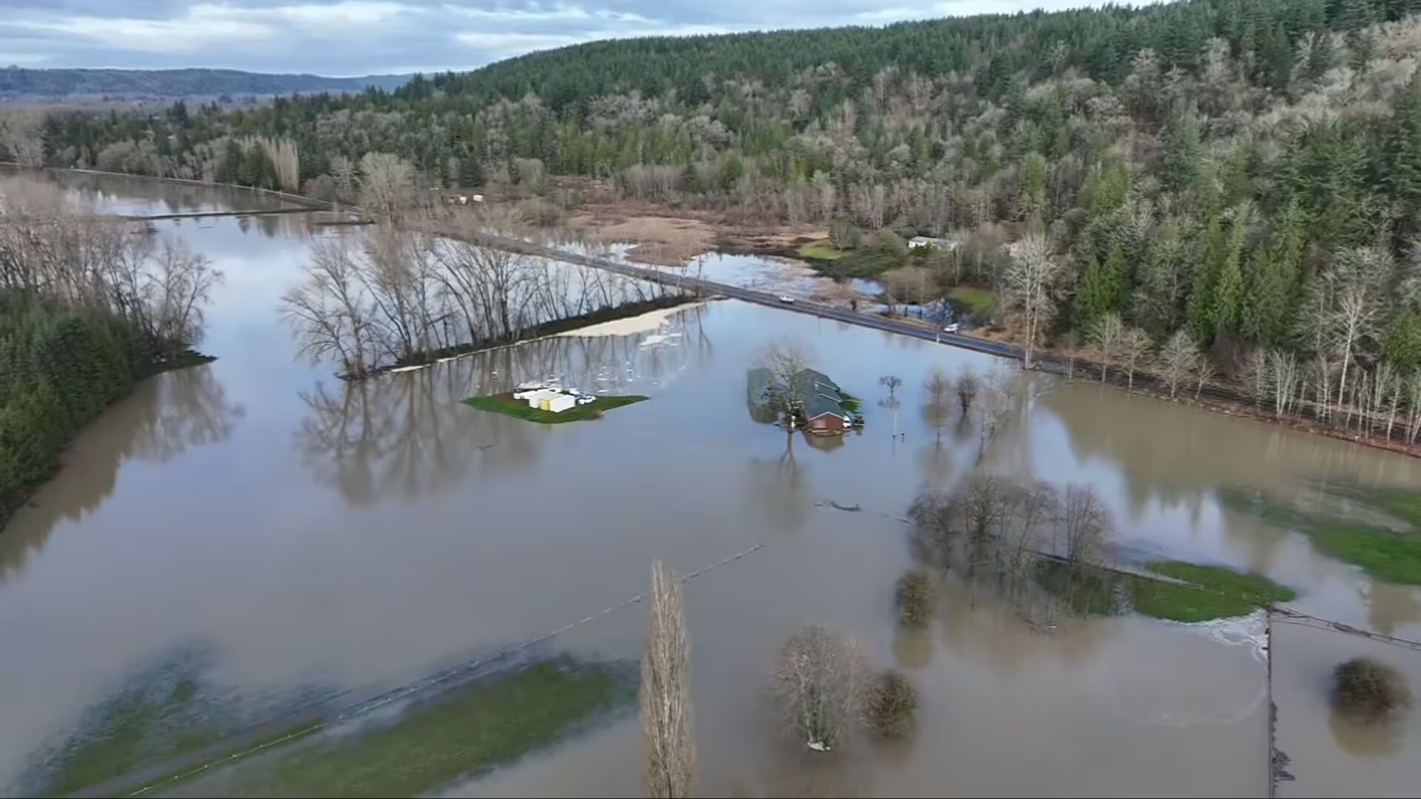
The most devastating event occurred in November 2006, when an unprecedented storm dropped 18 inches of rain in 36 hours, triggering massive flooding throughout the park. The Carbon River Road suffered extensive damage, contributing to the park’s longest-ever closure (six months, until May 2007). Large sections of the road were destroyed, joining Ipsut Creek and forming gullies.
Following the 2006 flood, the National Park Service made the decision not to rebuild the Carbon River Road for vehicle access beyond the park entrance, citing the high cost and the near certainty of future flood damage. Instead, the damaged roadbed was converted into the current Carbon River Trail, open only to hikers and bicyclists. The Ipsut Creek Campground at the road’s former terminus transitioned into a backcountry campsite. This decision fundamentally reshaped access within the Carbon River corridor, establishing a non-motorized paradigm dictated by the river’s natural forces.
The Carbon River area, therefore, has long been characterized by access fragility due to natural hazards. The recent failure of the external Fairfax Bridge adds a layer of man-made infrastructure failure atop this inherent environmental vulnerability, compounding the access challenges for this region of the park.
Uncertain Future: No Funding, No Timeline for Restoring Access
With the Fairfax Bridge permanently closed, WSDOT has initiated a planning study to determine the future of the SR 165 crossing over the Carbon River Canyon. The agency is evaluating three primary options:
- No Build: Keep the bridge permanently closed and do not replace it. This would mean the current lack of access becomes permanent.
- Replacement: Construct a new bridge in the same general location.
- Rerouting: Build a new segment of SR 165 on a different alignment, either east or west of the current canyon crossing.
However, a critical barrier exists for the latter two options: WSDOT has confirmed there is currently no funding available to replace the bridge. This stark financial reality elevates the “no build” scenario from a mere planning alternative to a very real potential outcome unless substantial new funding is secured. WSDOT is actively engaging with the Governor’s office, partner agencies, and the state Legislature to explore potential next steps and funding avenues.
The agency plans to hold in-person and online open house events after Memorial Day 2025 (dates to be announced) to gather public feedback on the potential options. However, no timeline for a decision or potential restoration of access has been provided. The complexity and potential cost of replacing or rerouting the highway are significant. For comparison, the replacement of the similarly aged Elwha River Bridge near Olympic National Park involved eight years of planning and public meetings followed by a year of construction, ultimately costing $42 million. This precedent suggests that even if funding were secured for the Fairfax Bridge, restoring access would likely be a lengthy and complex process involving significant inter-agency coordination and political will. The future of public access to the Carbon River and Mowich Lake areas via SR 165 remains highly uncertain.
Aging Infrastructure Cuts Lifeline to Rainier Wilderness
The permanent closure of the 103-year-old SR 165 Fairfax Bridge marks a significant disruption for Mount Rainier National Park and the surrounding region. Driven by critical structural failures after decades of service and deferred maintenance, the closure has indefinitely severed the primary public access route via SR 165 to the park’s unique Carbon River and Mowich Lake areas. This loss is acutely felt by recreationists seeking the trails, glaciers, and temperate rainforest of the park’s “quieter side,” as well as by local communities reliant on visitor traffic, particularly with the closure occurring just before the peak summer season.
The bridge’s demise underscores the tangible consequences of aging infrastructure and chronic underfunding for essential maintenance and preservation work—a challenge faced not just at this crossing, but across Washington state’s transportation network. While WSDOT explores potential long-term solutions, including replacement or rerouting SR 165, the complete lack of current funding casts serious doubt on if, or when, access might be restored. The “no build” option remains a distinct possibility.
Ultimately, the Fairfax Bridge closure serves as a stark reminder of the vulnerability of access to public lands when critical infrastructure fails. It highlights the difficult choices confronting policymakers regarding investment priorities, the long-term costs of deferred maintenance, and the future accessibility of cherished natural landscapes like Mount Rainier National Park.Sources used in the report.