Loading...
Navigating the Unknown: Mastering Map with Compass Skills for Beginners

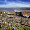
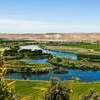
Navigating the wilderness with confidence starts with mastering the essential duo: a map with compass. This timeless technique, unswayed by technology's whims, stands as the bedrock of outdoor adventure, ensuring hikers and orienteers chart their course accurately, regardless of digital disruptions. With different tools like the dependable baseplate compass favored by backpackers for its simplicity, to the precise lensatic type—navigating through nature's labyrinth transforms into a gratifying triumph over the unknown.
Embarking on this journey of discovery, readers will learn the fine art of map reading and compass usage, from deciphering map symbols and scales, understanding the integral parts of a compass, to the critical skill of adjusting for magnetic declination. Each step is a stride toward self-reliance in the great outdoors, with practical guidance on taking bearings, orienteering without a GPS, and the life-saving techniques of navigation when technology falls silent. This article serves as your guide, assuring that with each page, you stride closer to becoming an adept navigator, turning every adventure into a story of mastery over the elements.
Understanding Map Symbols and Scales
To proficiently navigate with a map and compass, one must become fluent in the language of map symbols and scales. These symbols are the critical elements that transform a mere piece of paper into a treasure trove of information, guiding adventurers through diverse terrains and landscapes.
Map Symbols:
• Natural Features: Symbols representing rivers, lakes, mountains, and forests help hikers to identify and appreciate the lay of the land.
• Man-Made Features: Look for symbols that denote roads, buildings, bridges, and airports, which are vital for understanding human-made changes in the environment.
• Color Coding: Different colors in a map key represent various categories, with green often signifying natural outdoor spaces, and orange marking areas of human interest like dining and drinks.
Map Scales:
• Representative Fraction (RF): This ratio, such as 1:24,000, means that one unit on the map corresponds to 24,000 units in reality, providing an exact measure of distance.
• Word Scales: An expression like "1 inch equals 1 mile" offers a more intuitive understanding of the map's scale, ideal for quick reference during a hike.
By familiarizing oneself with the map's legend or key, navigators can effortlessly interpret the map symbols https://pubs.usgs.gov/unnumbered/70039582/report.pdf and understand spatial relationships, whether plotting a route or pinpointing their current location. Additionally, topographic maps https://www.quora.com/Where-do-you-find-legends-and-scales-on-a-map with their contour lines depict elevation changes, aiding in visualizing the terrain ahead. Recognizing these symbols and scales is not just a skill but a gateway to mastering direction, navigation, and the art of orienteering.
The Parts of a Compass and Their Functions
To adeptly navigate using a map with compass, understanding the various components and their functions is key. Here's a breakdown of a compass's parts:
• Baseplate: The foundation of the compass, this transparent piece is marked with scales or rulers, essential for measuring distances on maps and ensuring accurate map reading
• Compass Needle: Always pointing toward Magnetic North, this needle can be influenced by nearby magnetic or ferrous materials, so keep cell phones at a distance for accurate
readings.
• Rotating Bezel/Azimuth Ring: This ring, marked with degrees from 0 to 360, is rotated to align with your intended bearing. North is at 0˚, East at 90˚, South at 180˚, and West at
270˚.
• Index Line: Located on the baseplate, this line shows where to read the bearing from the bezel.
• Direction of Travel Arrow: Point this arrow toward your destination or landmark to set your course.
• Orienting Arrow: Within the vial, this arrow aligns with the compass needle in the field; remember the mnemonic "put Red in the Shed" to correctly orient yourself.
• Vial/Housing: This contains the compass needle and can be air or liquid-filled, with the latter providing a steadier needle for easier reading.
• Lanyard: A practical addition for carrying your compass and can be used to measure distances on your map.
For those who venture beyond the basics, some compasses come equipped with additional tools like luminous markings for low-light conditions, bezel locks to secure your bearing, and even integrated clinometers for measuring slopes. These extra features can enhance your navigation experience, especially in challenging environments or when precise measurements are crucial.
Understanding these components is not just about knowing your equipment; it's about building the confidence to navigate through the wilderness, to find your latitude in the world, and to chart a route that leads to discovery and adventure in the great outdoors.
To ensure accurate navigation while hiking or orienteering, setting your map with a compass is a fundamental skill. Here's how to align your maps with compass for effective route finding:
1. Aligning the Map: Begin by placing your compass flat on the map. Rotate the map and compass together until the red needle on the compass aligns with the 'N' on the compass bezel, ensuring that the map's north is pointing true north.
2. Map and Compass Synchronization: Line up the vertical grid lines (eastings) on the map with the compass's eastings lines. This step is crucial for establishing a correct baseline for your direction and position.
3. Magnetic North Alignment: Adjust the map so that the compass needle, indicating magnetic north, aligns with the map's grid north. This synchronization ensures that your map reading is not skewed by magnetic variations.
4. Orienting While on the Move: As you move, keep the map oriented by turning your body with the map, not just your hands. The top of the map should always be in the direction you are facing.
5. Frequent Checks: In competitive orienteering, it's recommended to glance at your compass every 4-5 seconds to stay on course.
6. Map Management: Fold your map so the current leg of your journey is near your hand, simplifying map reading while on the go.
7. Advanced Techniques: Practice resection to identify features on the map and use your compass to pinpoint your location. If disoriented, set a panic azimuth to a known road or landmark to regain your bearings.
Remember, when using an orienteering compass, the correct alignment of north on both the map and compass is essential for accurate navigation. These steps combined with regular practice will enhance your proficiency in using maps with compass, and ensure that your outdoor adventures are both safe and enjoyable.
Adjusting for Magnetic Declination
Navigating the wilderness with a map and compass often leads to the realization that magnetic north and true north are not the same—a concept known as magnetic declination. Here's how to adjust for this critical difference:
• Find the Local Declination: Before setting out, determine the magnetic declination for your area. This information is readily available on topographic maps or through resources like the NOAA website.
Adjusting Declination on a Compass:
• For Brunton compasses, firmly hold the bezel, pinch the center hub with your thumb and forefinger, and rotate to set the declination indicator over the correct value.
• Suunto compass users should flip the compass, insert a metal key into the adjustment screw, and turn until the declination indicator aligns with the local declination value, either east or west of 0°.
• Navigating with Non-Adjustable Compasses: If your compass lacks declination adjustment:
• Add the declination value to your bearing when going from map to field if the declination is east (positive number).
• Subtract the declination value if it is west (negative number).
• Reverse the process when transferring bearings from the field to your map.
By mastering declination adjustments, navigators can ensure their direction and route planning is accurate, enhancing their confidence and safety while hiking or engaging in orienteering. Whether using an adjustable compass or compensating manually, understanding and applying these techniques is essential for precise navigation and enjoying the adventure that awaits in the great outdoors.
Taking Bearings and Navigating to Points
To effectively navigate to a point of interest using a map with compass, follow these steps:
8. Locate Points of Interest: Identify your current location and your desired destination on the map.
9. Determine Direction of North: Ensure the map's orientation with the compass pointing to North.
10. Place and Align Compass: Set the compass on the map between the two points. Align the edge of the compass with the points of interest.
11. Twist Housing: Rotate the compass housing until the orienting lines are parallel to the map's North lines, ensuring the red arrow points to North.
12. Confirm Alignment: Double-check that everything is lined up correctly—compass needle with orienting arrow, and map with magnetic North.
13. Note Bearing: Read the bearing at the index line; this is the direction you will travel.
When navigating:
• Periodic Bearing Checks: Regularly take bearings to known landmarks to stay on course, ensuring your direction is true.
• Use of Back Bearings: If it's easier to identify where you're coming from rather than where you're going, take a back bearing to maintain orientation.
• Following Bearings: To follow a bearing on the ground, hold the compass level, line up the specified bearing with the direction-of-travel arrow, and ensure the orienting arrow and
magnetic needle are aligned. Then, proceed in the direction of the travel arrow.
• Distance Estimation: Always keep track of how far you've traveled to gauge your progress accurately.
• Correct for Declination: Adjust the bearing for magnetic declination, which varies over time and location.
• Triangulation for Lost Situations: Use triangulation with three visible landmarks to determine your position if lost.
By mastering these steps and methods, you can confidently use maps with compass for hiking, orienteering, and other outdoor adventures, ensuring you can navigate the terrain and reach your desired latitude and route with precision.
Using a Compass Without a Map
In the absence of a map, a compass remains a steadfast ally in the wilderness, guiding adventurers towards their intended direction with its unwavering needle. Here's how to harness its capabilities for navigation:
Setting a Bearing:
• Hold the compass flat in your hand.
• Turn your body until the direction of travel arrow points towards your desired destination.
• Keep the magnetic needle aligned with the orienting arrow and proceed in the direction the travel arrow indicates.
• Regularly check the compass to ensure you're maintaining the correct latitude
Natural Navigation Aids:
• Use the sun: In the Northern Hemisphere, the sun rises in the east and sets in the west.
• Locate the North Star (Polaris): In the night sky, find 'the Big Dipper' and follow the 'pointer' stars to Polaris, which sits roughly in line with Earth's axis and points north.
• Identify landmarks: Recognizable features like mountains or rivers can serve as reference points to maintain your direction
Advanced Techniques:
• Triangulation: If you can see two known landmarks, measure the bearing from you to each, then use these bearings to approximate your position.
• Pace Counting: Employ Naismith's rule to estimate travel time, considering both distance and elevation changes, to avoid being caught unprepared by nightfall.
While magnetic declination is a minor concern without a specific route in mind, adventurers should still be aware of its potential to influence bearings slightly. By mastering the use of a compass in conjunction with natural cues and a keen sense of navigation even without a map, one can confidently traverse the wilderness and enjoy the freedom of exploration.
So get outside and test out your map and compass skills and just incase have a gps as a backup!
Please support The OutdoorsNW by subscribing today!
You may also like:


.png)